Bike Tourism
Cycle Oregon Connections
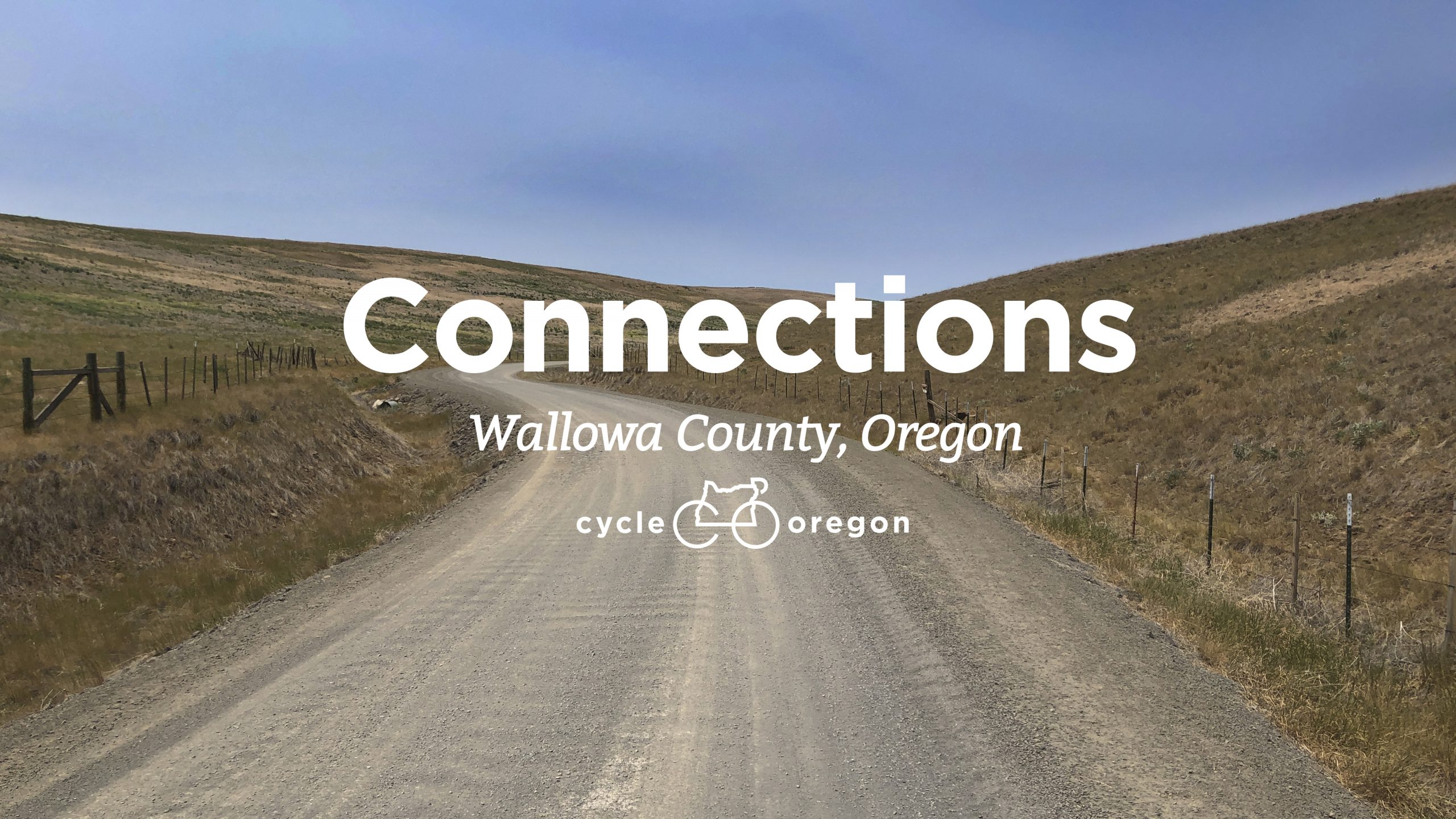
We launched our Community of Giving membership program by saying this, “2021 begins the journey of developing a more comprehensive and impactful Cycle Oregon.” We’ve been at work on a number of new efforts in addition to our events that will benefit Oregon communities and we are excited to share one here – Connections.
Cycle Oregon Connections was developed to highlight the diversity of Oregon through inclusive history and experiences as shared by local communities. We understand how close to a community you can get by bike and through Connections we introduce and elevate a range of rural voices who share the lesser known, and often lesser told, histories and heritages of where they call home. There is no better way, in our opinion, to experience and understand the where and why of a community than by bicycle.
Our first Connections feature includes routes for road and gravel from 1.5 miles to 40+ miles that will take riders through the communities of Wallowa, Enterprise, Lostine, and Joseph, Oregon. In partnership with the Maxville Heritage Interpretive Center and the Nez Perce Wallowa Homeland, Connections reveals the early history of Black and Indigenous people in Eastern Oregon and elevates rural voices that have often gone unheard. Connections includes a guide to Travel Oregon’s Bike Friendly Businesses along with a focus on Women & BIPOC owned local businesses on Connections routes. Click here to view Connections – Wallowa County
Oregon Scenic Bikeways
Scenic Bikeway routes are some of the best bike rides in Oregon. They showcase beautiful scenery, state history and local communities. They run past state parks on paved paths and roads, cross mountain passes and high desert plains, and meander through lush farmlands and covered bridges over sparkling streams. The Oregon Scenic Bikeway program is the first of its kind in the country, with official state-designated routes, printable maps and on-road signage.
Thanks to our friends at Oregon State Parks who manage the Scenic Bikeway program. View the entire map here and browse by difficulty below.
-
Mild
Fun, casual rides appropriate for nearly everyone. The traffic is light and the terrain is mostly flat.
 Covered Bridges, 35-mile loop, map and cue sheet | Ride with gps
Features covered bridges, lake views and colorful foliage in the fall. The ride passes through the historic Cottage Grove downtown and includes the 17-mile Rowe River Trail. It can be ridden as an out-and-back on the pathway or as a loop with one half on the the path and the other on scenic low-traffic roads.Best seasons to ride: year round (expect rain in winter). Video
-
Moderate
Rides that aren’t for beginners, but aren’t a major undertaking for those who ride regularly.
 Madras Mountain Views, 30 mile loop, map and cue sheet | Ride with gps
The route starts in Madras, a small town with hotels, a craft beer pub and several restaurants. As you ride along the rim overlooking Lake Billy Chinook, look for the basalt palisades and seven spectacular peaks in the Cascade Mountain Range.Best seasons to ride: spring through fall; very hot in the summer; possible winter riding, check weather report before going. Video
 Sisters to Smith Rock, 37 miles one way, map and cue sheet | Ride with gps
Roll by pastures of grazing alpacas silhouetted against the snow-covered Cascade Mountains on your way to Smith Rock State Park, famous for its multi-colored rock formations. The elevation gain or loss is about the same from either direction. The route starts in downtown Sisters and passes through Terrebonne.
Best seasons to ride: spring through fall. Video
 Twin Bridges Loop, 36-mile loop, map and cue sheet | Ride with gps
The ride is a showcase of Central Oregon’s snow-capped Cascade Mountains, rimrock canyons, high desert terrain and the Deschutes River. The route starts in bustling downtown Bend and passes through the small town of Tumalo.
Best seasons to ride: spring through fall. Video
 Tualatin Valley — 50 miles one way, map and cue sheet | Ride with gps
Leave the urban setting of Hillsboro and quickly enter the lush Tualatin River basin, which is dotted with wetlands, small forests, vineyards and views of the Coast Range. The ride passes through Forest Grove. Half of the bikeway is on the Banks-Vernonia State Trail, a paved path leading to the small town of Vernonia.
Best season to ride: year-round (expect rain in winter) Video
 Willamette Valley — 135 miles one way, map and cue sheet | Ride with gps Southbound Northbound
Cycle through one of the most productive and beautiful agricultural valleys in the world and known for pinot noir wine, hops for brewing beer, hazelnuts and marionberries. This mostly flat route passes through Salem, Albany and Brownsville.
Best seasons to ride: year round (expect rain in winter) Video
.jpg) Wild Rivers Coast, 60 miles out and back, map and cue sheet | Ride with gps
Wild Rivers Coast, 60 miles out and back, map and cue sheet | Ride with gpsViews from the ride include the Wild and Scenic Elk River, lush cranberry bogs, towering basalt sea stacks and vast ocean views. Start your tour in the quaint fishing hamlet of Port Orford, the oldest town on the Oregon coast, with inviting locally owned hotels, restaurants and eclectic art galleries.
Best seasons to ride: year round; some sunny days in mid-winter. Video
-
Challenging
Perfect experiences for cyclists looking for good, hard rides that involve a combination of mileage and climbing. Casual cyclists will not enjoy these rides.
 Grande Tour, 134-mile loop, map and cue sheet | Ride with gps
This ride is the grande tour of mountain ranges, including eastern Oregon’s Eagle Cap Mountains, the Elkhorn Range, the Blue Mountains and the Wallowa Mountains. The towns of LaGrande, Baker City, Union and North Powder are spaced perfectly to stop for supplies or for the night.
Best season to ride: spring through fall, mid-summer can be very hot. Video
 Old West, 174-mile loop, map and cue sheet | Ride with gps
Start in John Day at the Kam Wah Chung State Heritage Site, now a museum but once a general store, apothecary and religious center. The museum offers a snapshot of the Chinese immigrant experience in the 19th and 20th century American west. Cycle past the Strawberry Mountain Wilderness and the Fossil Beds National Monument.
Best season to ride: spring through fall, mid-summer can be very hot. Video
 Cascading Rivers, 70-mile one way, map and cue sheet | Ride with gps: Estacada start Detroit start
Ride along the Clackamas and Breitenbush rivers from Estacada to Detroit, with very little but wilderness, rivers and trees along the route.
Best seasons to ride: Late spring through early fall; road closes each winter due to snow. Video
-
Extreme
These are the epic rides. Cyclists had better be in top shape, climb like a mountain goat and go all day.
 Blue Mountain Century, 108-mile loop, map and cue sheet | Ride with gps
This is one century ride you won’t want to complete in a single day. Be ready for big hills and a total elevation gain of 8,000 feet. Starting in Heppner with Ukiah at the halfway mark, this route is remote and includes breathtaking views of the Blue Mountains.
Best seasons to ride: Early summer and fall, mid-summer can be very hot. Winter snow closes a section of road. Video
 Cascade Siskiyou, 55-mile loop, map and cue sheet | Ride with gps
A steep and winding 5,000-foot climb through oak savannah into fir forests showcases this ecologically diverse ecosystem. The route opens to spectacular views of the Bear Creek Valley and Pilot Rock, a 25-million-year-old volcanic plug. The ride starts in Ashland, famous for theater and outdoor recreation.
Best season to ride: spring through fall. Video
 McKenzie Pass, 35 miles one way, map and cue sheet | Ride with gps
Start in Sisters and follow an 1860s wagon route that includes views of Mt. Washington and lava flows. The steep descent to Belknap Hot Springs has switchbacks through dense, verdant Cascadian forests. This bikeway is closed to motor vehicles each spring for car-free riding. Snow and car free riding update
Best season to ride: summer and fall. Road closes due to snow each winter. Video
 Oregon Outback — 89 miles loop, map and cue sheet | Ride with gps
Nestled in the beautiful Warner Mountains, the route starts in Lakeview where the forests meet the High Desert Basin and Range. Ride past gorgeous lakes with the chance to see pronghorn, wetland birds, bighorn sheep and sage grouse.
Best seasons to ride: early spring through fall.
 Painted Hills, 130 miles total, map and cue sheet | Ride with gps
Meander through the multi-hued natural history on this route, which connects the small communities of Fossil, Service Creek, Spray and Mitchell and the John Day Fossil Beds National Monument. Viewed from your bicycle seat, you can see millions of years of geology revealed in the layers of earth, one color at a time.
Best seasons to ride: late spring through fall. Video
Ride With GPS Ambassadors
Riders the world over post and share their treasured routes to this easy-to-use platform that also happens to be an Oregon-based business. We are proud to be a Ride With GPS Ambassador (with an additional Area Ambassador designation) and offer a selection of our favorite rides across the state. Our most recent is the C2C, (Corvallis to the Sea), a 60-mile route from the Willamette Valley to the Pacific Ocean. Few experiences capture the magic and beauty of Oregon’s Coast Range like riding the C2C, check it out and make plans for 2022!